 |
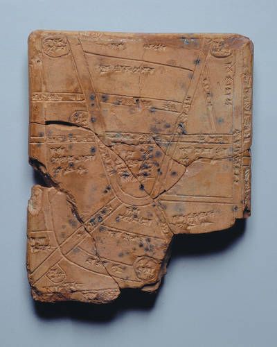
This page is to show all the materials with which maps can be and have been made, starting from the earliest times down to the present and into the future. The first map is a clay tablet from Nippur (in Iraq) and dated to 1400 BCE. If you are wondering why I do not use BC and AD in my dates. Since I am no longer religious (and believe me, I was raised in a very religious family) I don't like using anything referring to religion and BC and AD are both religious references. So I use the neutral dating system. BCE means Before the Common Era and CE means the Common Era. |
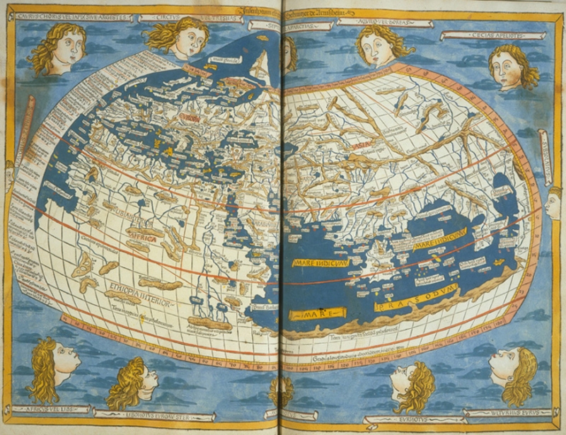 | This version of Ptolemy's Geographica World Map was actually a woodcut made in 1427 CE and is the earliest surviving known version of Ptolemy's map which was originally made in 150 CE. |
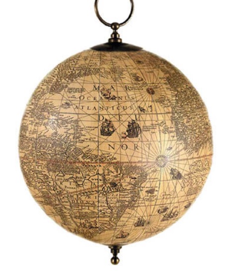 | This is a free hanging globe of an antique map made by Jodicus Hondius, who was a master map maker from the Netherlands in the 1600's. |
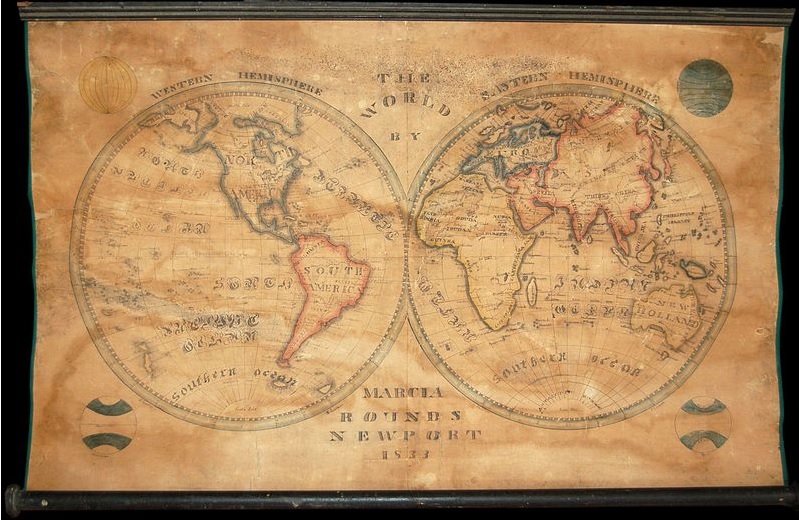 | This stunning schoolgirl map was hand drawn by Marcia Rounds of Newport Rhode Island in 1833. Schoolgirl maps began appearing in England and the United States in the later part of the 18th and the early 19th century. These wonderful, fascinating, and often whimsical maps are the product of a radical change in the education of women taking place at this time. Girl's schools, which formally concentrated only on the "womanly arts," began to see a need to educate women in such subjects as geography, mathematics, and science. This transition occurred at a period of globalization, prosperity, and colonization. Men were ever more frequently called away from home by the exigencies of war, economy, and the administration of global empires. Women were thus left in control of their lives and finances on the home front. The education system of the period responded to these changes by advancing studies for women in history, geography, and hard sciences. Unfortunately, many of these progressive schools were highly underfunded and lacked proper educational materials such as maps and books. One way of adapting was to learn geography by copying maps and atlases borrowed from other institutions. Schoolgirl maps appear in a variety of formats, including embroidery, painting on cloth, and drawings on paper, ivory, and wood. Many schoolgirl maps are must be considered as much folk art as cartography. For more details on this map, see School Girl Maps |
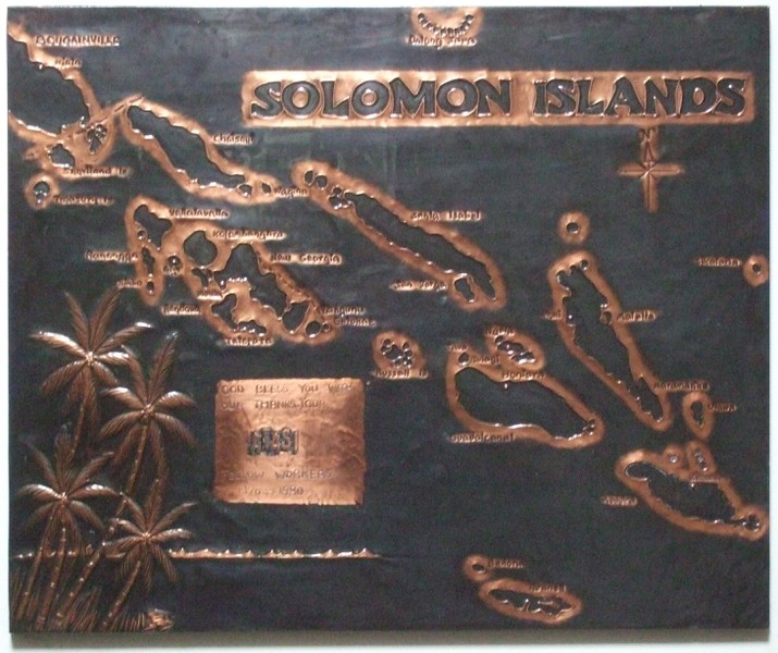 | This copper map of the Solomon Islands was made by students at the Betikama Seventh-Day Adventist college (secondary school) in the late 1970s. It was given to my parents as a farewell gift in 1980 upon their decision for the family to leave the Solomon Islands and return to their home country. ATASI was the name of the business my father spent three years working for. |
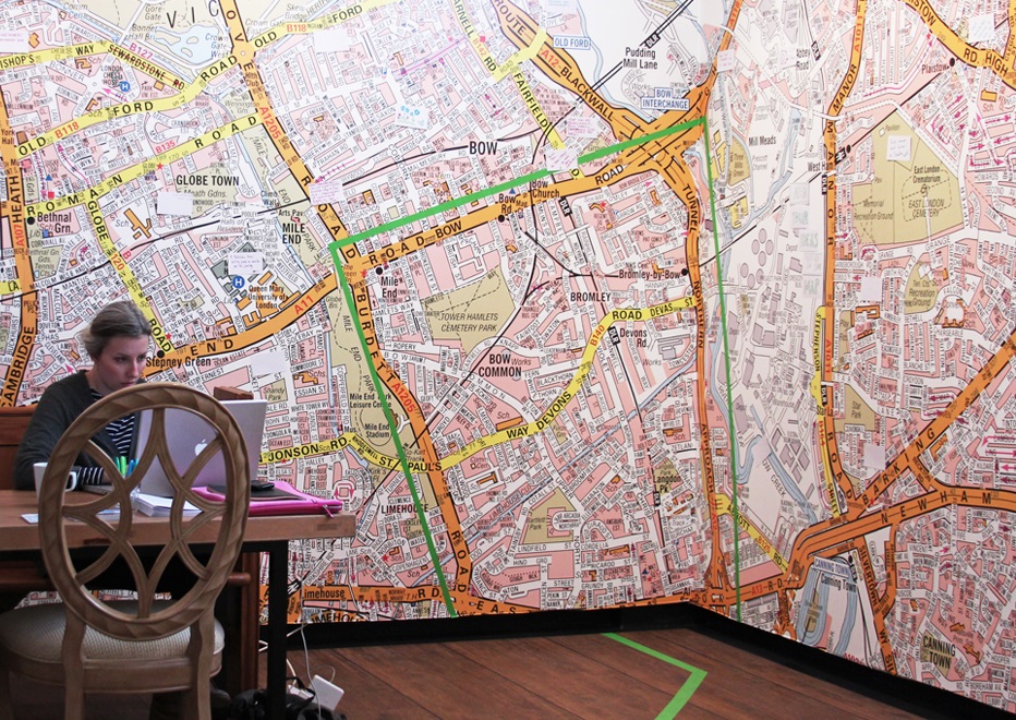 | I LOVE the idea of large maps on the wall. But there are very few images of wall maps. I found this one of a map of central London. The girl at the table is using a laptop which dates this image to the early 21st century at the very least. |
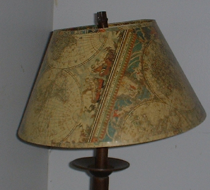 | This is a lamp I purchased some years ago, because it had an antique map on it. I have no idea which map this is, or who made it, but the idea that a map can be made into a lamp is interesting. |
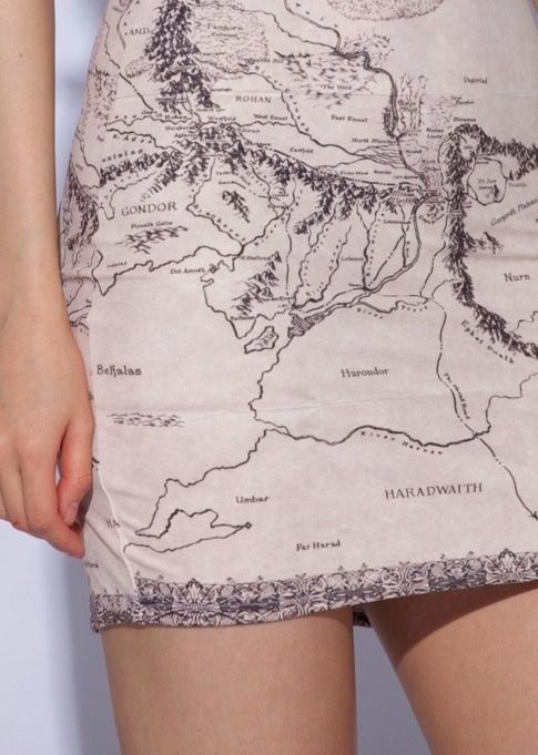 | The map of Rohan and Gondor from The Lord of the Rings Books and Movies (1999 - 2003) has even been designed for dress fabrics. This is what the map looks like when seen on an actual dress as worn by a woman. |
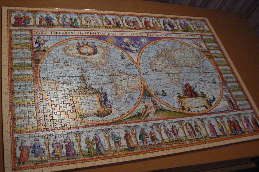 | This is a jigsaw puzzle of an antiquarian map that was originally made in 1639. |
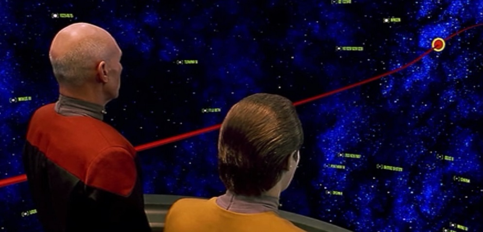 | This is one possible future of cartography and map-making. This shows the Stellar Cartography Room from the 1994 Star Trek Movie - Generations. |